Real Time GIS Mapping with Live Connect (BM-141)
Real-time mapping is the process of mapping points of interests (POI's), through using GPS capable mobile devices that connect via the internet.
Business Mapper uses these technologies to make mapping cheaper and fast.
Live Connect
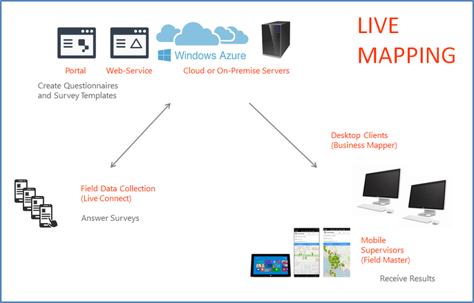
Based on mobile phones with a GPS chip and a Camera, live connect is able to customize surveys and send data in real time. The surveys can then be consumed by a Business Mapper client or Field Master for field supervisors.
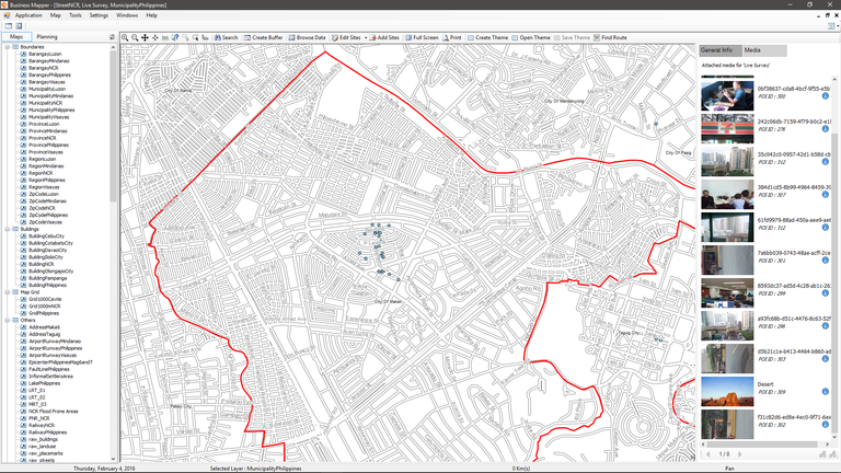
Live Connect is also capable of sending Photos associated with a Survey. This tool is great for audit functions and for detailed field data such as customer profiles.
Field Master
Ideally used on a tablet, Field Master is able to download all survey data submitted by Live Connect. Users can choose to download data based on current GPS position, or a map pinned location.
Some applications for Field Master involves downloading customer information or constituent data, based on a person current location.
Illustration 1: (How Live Connect Works)

Illustration 2: (Live Connect submissions with Photos viewed from Business Mapper)

Business Mapper Team
