Mcdonald's Branches - Proposed Sites (Ref: BM-104)
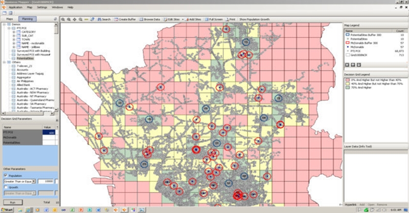
Using Business Mapper, we can pin-point specific areas that meet a certain business density per square kilometer. In the image above the red buffers show existing Mcdonalds branches and the blue buffers indicate proposed new sites.
The map displayed uses a GRID which is cut 1 sqkm. The buffers are 300 meters in diameter.
The area's business density was derived from POI Managed Service of Business Mapper. Using maintained and up-to-date Points-of-Interest(POI) data ensures that assumptions are relevant.
Note: If this article leads to you making an inquiry to us, please use reference RE: BM-104 when you email us with your inquiry.